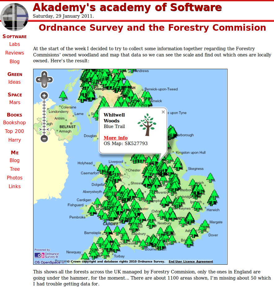
At the start of the week I decided to try to collect some information together regarding the Forestry Commissions’ owned woodland and map that data so we can see the scale and find out which ones are locally owned. (Jump to the app here if you’re impatient!).
Continue reading “The Forestry Commission, OpenData and Ordnance Survey”

